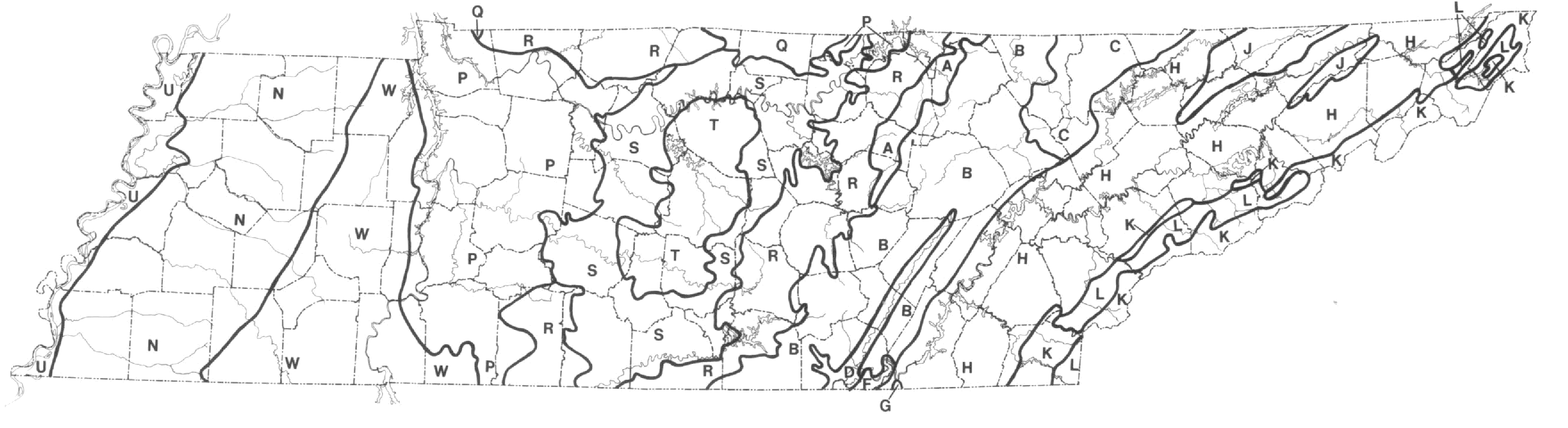
Figure 6: Ecoregions (Fink and Elder, 1982). Area labeled A denotes Cumberland Benches and Escarpment, B - Cumberland Plateau, C - Cumberland Mountains, D - Sequatchie Valley, F - Sand Mountain, G - Lookout Mountain, H - Great Appalachian Valley, J - Appalachian Sandstone Capped Ridges, K - Blue Ridge High Mountains, L - Blue Ridge Valleys and Low Mountains, N - Loess Belt, P - Highland Rim (Pennyroyal) Cherty Hills, Q - Pennyroyal (Highland Rim) Low Limestone Hills, R - Highland Rim (Pennyroyal) Plains, S - Outer Nashville Basin, T - Inner Nashville Basin, U - Mississippi Bottomland, and W - Coastal Plain Hills.

APSU Homepage |
APSU Department of Biology |
APSU Center for Field Biology
This document was adapted to the WWW by Rusty Smith and Carol Mayo.